A description of the empire of China and Chinese-Tartary, together with the kingdoms of Korea, and Tibet. Containing the geography and history (natural as well as civil) of those countries ... / from the French of P.J.B. DuHalde, Jesuit, with notes geographical, historical and critical and other improvements, particularly in the maps by the translator.
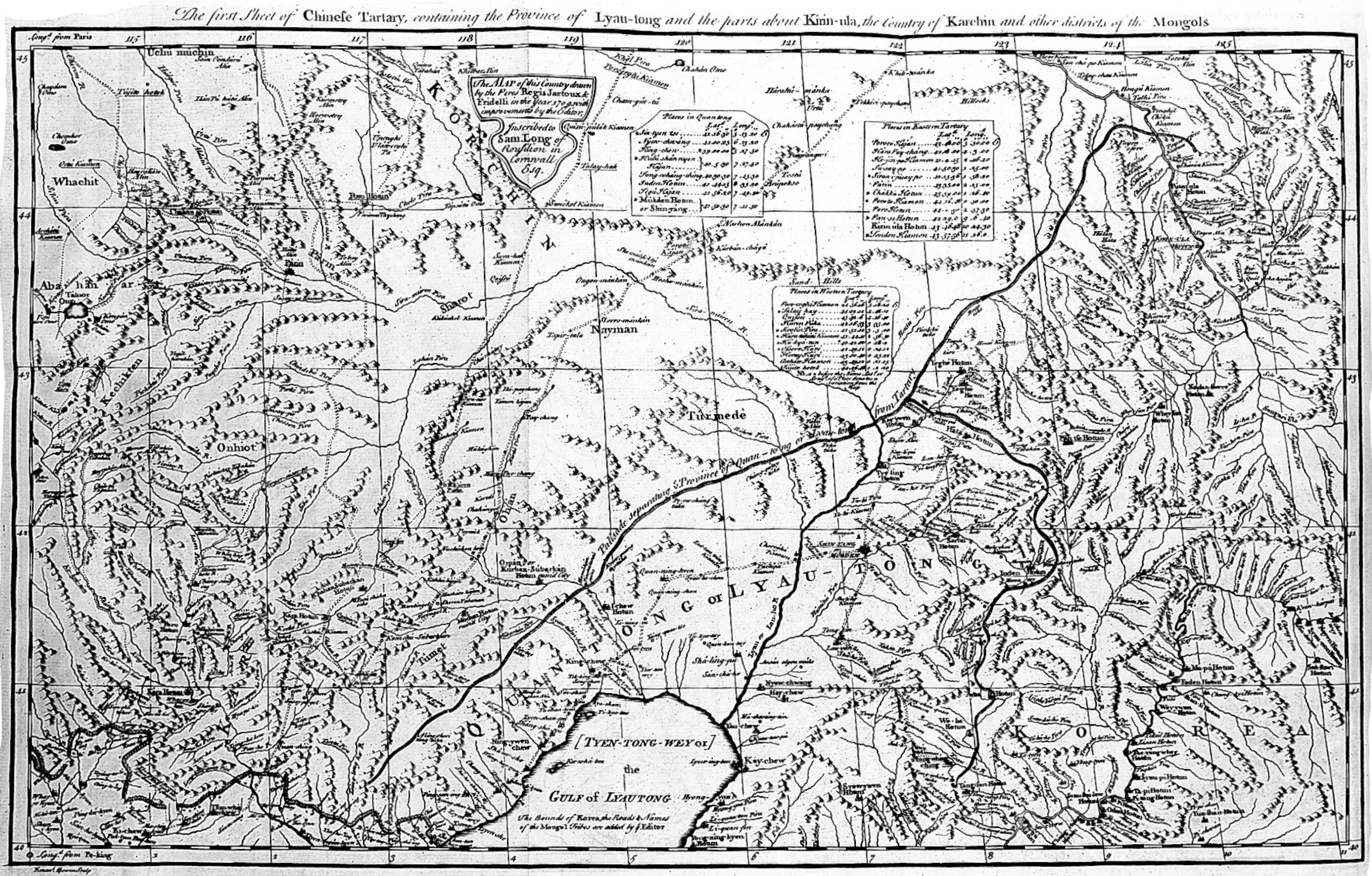
An engraved map titled across the top as the first part of Chinese Tartary, with dense hachured mountain ranges, a winding river and route line, and text cartouches and inscriptions in the upper area. Labels mark the Grand Lama's territory near the lower center, with place names printed in small type across the sheet.
- Artist
- Jean-Baptiste Du Halde
- Date
- 1738-1741
- Medium
- Source
- Wellcome Collection
- Size
- 4000 × 2554 px
Rights checked 2026-11-05 · tier A · as stated by the source: Public Domain Mark (Wellcome Collection)
Credit (appreciated, not required for public-domain works): Wellcome Collection
Español: Mapa de Tartaria China y Tíbet, de la Descripción del Imperio Chino (1738-1741)
Mapa grabado con el título impreso en la parte superior como primera parte de la Tartaria China, con densas cordilleras sombreadas, un río sinuoso y una línea de ruta. Cartelas e inscripciones ocupan la zona superior, y una etiqueta cerca del centro inferior marca el territorio del Gran Lama.
Português: Mapa da Tartária Chinesa e do Tibete, da Descrição do Império da China (1738-1741)
Mapa gravado com o título impresso no topo como primeira parte da Tartária Chinesa, com cadeias montanhosas densamente sombreadas, um rio sinuoso e uma linha de rota. Cartelas e inscrições ocupam a área superior, e um rótulo perto do centro inferior marca o território do Grande Lama.