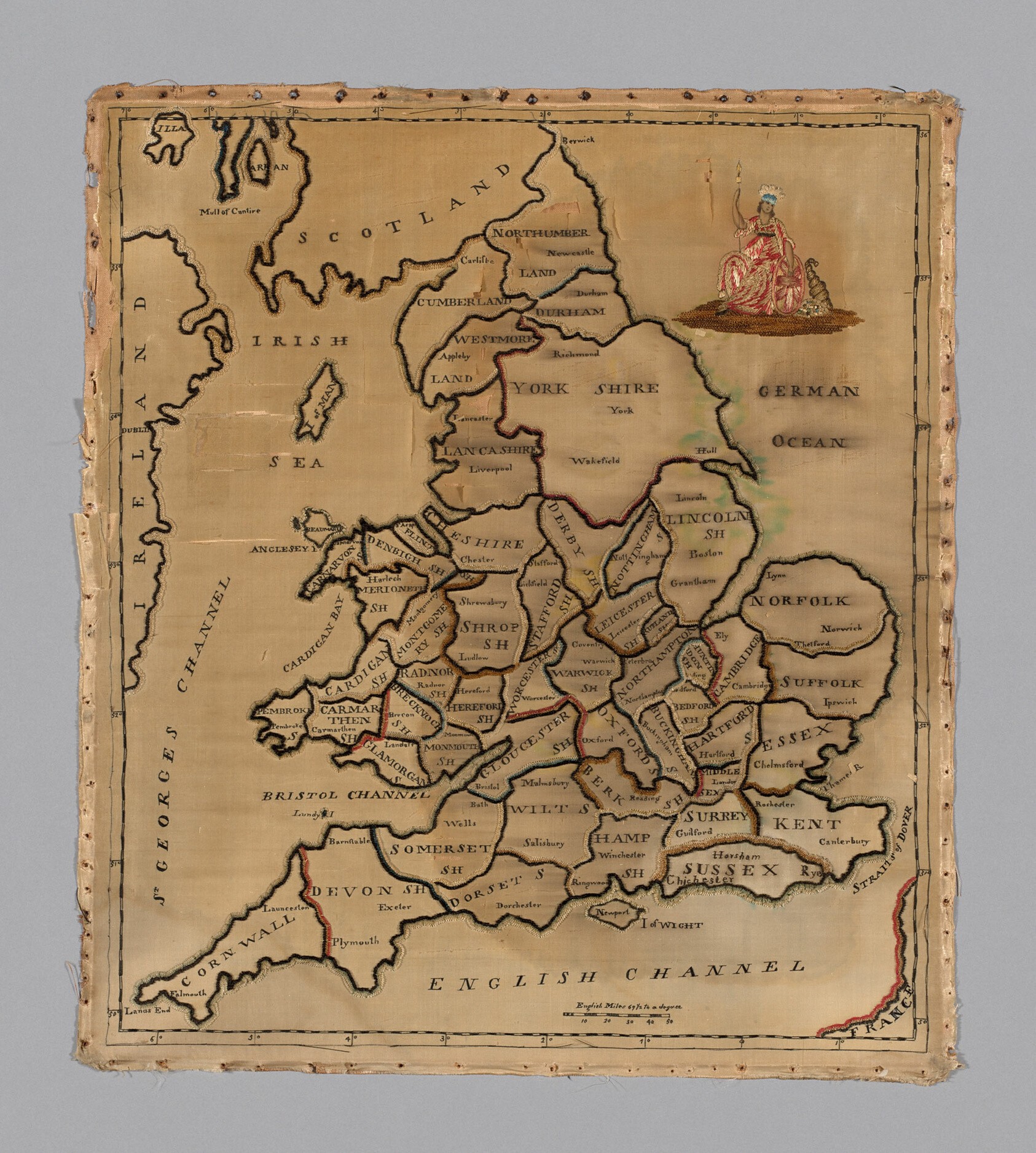
Mapa de Inglaterra y Gales, muestrario bordado
Un mapa bordado de Inglaterra y Gales sobre un fondo de seda pálida, con los condados delineados en hilo oscuro y sombreados en tonos apagados. Escocia, Irlanda y el mar de Irlanda aparecen arriba a la izquierda, y una figura femenina sentada, de rojo y blanco, está bordada arriba a la derecha.
- Artista
- Desconocido
- Fecha
- c. 1800
- Técnica
- Fuente
- Art Institute of Chicago
- Tamaño
- 1686 × 1876 px
Dominio público · Art Institute of Chicago releases this image under CC0 (latest date 1810).
Derechos verificados 2026-11-05 · nivel A · según la fuente: CC0 (Art Institute of Chicago, is_public_domain=true)
Derechos verificados 2026-11-05 · nivel A · según la fuente: CC0 (Art Institute of Chicago, is_public_domain=true)
Crédito (se agradece, no es obligatorio en obras de dominio público): Art Institute of Chicago, Gift of Mrs. Chauncey B. Borland