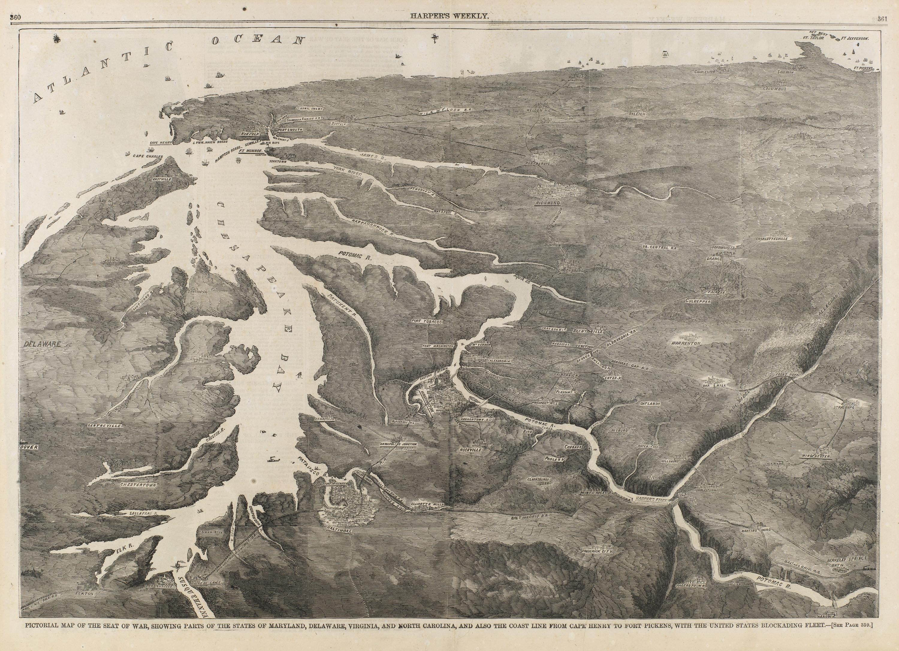
Pictorial Map of the Seat of War, Showing Parts of the States of Maryland, Delaware, Virginia, and North Carolina, and also the Coast Line from Cape Henry to Fort Pickens, with the United States Blockading Fleet, from Harper's Weekly, June 8, 1861
A wood-engraved pictorial map in grayscale shows the Atlantic coast and the Chesapeake Bay, with white water channels winding through dense hatched land and the ocean labeled across the top. The bottom margin carries the caption naming the blockading fleet and coastline from Cape Henry to Fort Pickens, with a Harper's Weekly page header.
- Artist
- Unidentified
- Date
- 1861
- Medium
- wood engraving on paper
- Source
- Smithsonian (Smithsonian American Art Museum)
- Size
- 3000 × 2172 px
Rights checked 2026-11-05 · tier A · as stated by the source: CC0 (Smithsonian Open Access)
Credit (appreciated, not required for public-domain works): Smithsonian Institution, Smithsonian American Art Museum
Español: Mapa pictórico del teatro de guerra, bahía de Chesapeake y costa atlántica, 1861
Un mapa pictórico xilografiado en escala de grises muestra la costa atlántica y la bahía de Chesapeake, con canales blancos de agua que serpentean entre tierras densamente rayadas, y el océano rotulado en la parte superior. El margen inferior lleva la leyenda que menciona la flota de bloqueo y la costa desde Cape Henry hasta Fort Pickens, junto al encabezado de Harper's Weekly.
Português: Mapa pictórico da frente de guerra, baía de Chesapeake e costa atlântica, 1861
Um mapa pictórico gravado em madeira, em tons de cinza, mostra a costa atlântica e a baía de Chesapeake, com canais brancos de água que serpenteiam entre terras densamente hachuradas, e o oceano identificado na parte superior. A margem inferior traz a legenda que menciona a frota de bloqueio e a costa de Cape Henry até Fort Pickens, junto ao cabeçalho da Harper's Weekly.