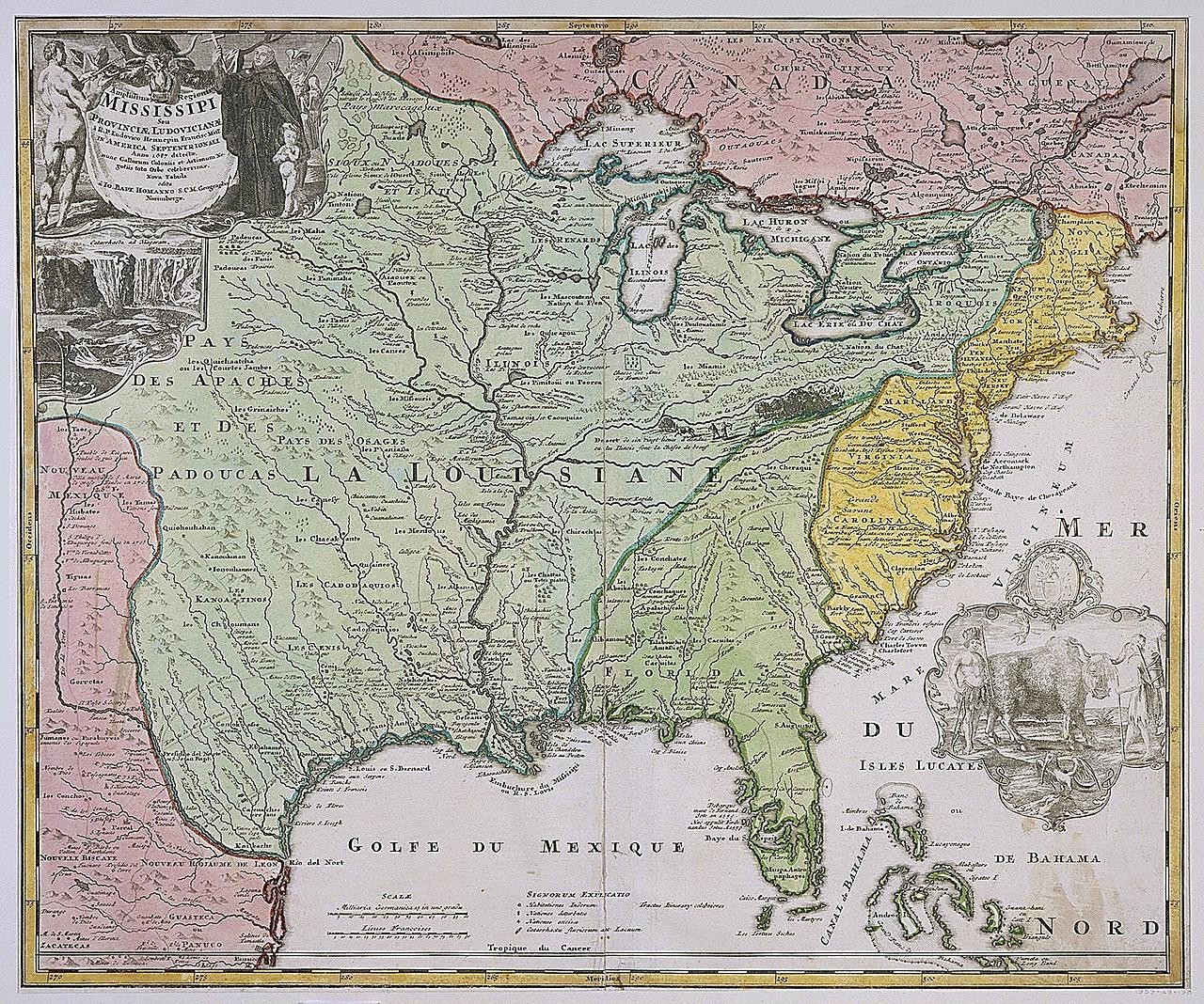
Mapa de Luisiana (Misisipi) de Johann Baptista Homann
Mapa grabado y coloreado a mano de la cuenca del río Misisipi y la costa del Golfo, con regiones verdes, rosas y amarillas y un cartucho decorativo en la esquina superior izquierda con figuras y una cascada. Las leyendas en francés indican el Golfe du Mexique, la Louisiane y los Grandes Lagos.
- Artista
- Johann Baptista Homann
- Fecha
- after 1718
- Técnica
- Etching and engraving, hand-colored, on white laid paper
- Fuente
- Smithsonian (Cooper Hewitt, Smithsonian Design Museum)
- Tamaño
- 1280 × 1068 px
Dominio público · Smithsonian (Cooper Hewitt, Smithsonian Design Museum) releases this image under CC0 (undated).
Derechos verificados 2026-11-05 · nivel A · según la fuente: CC0 (Smithsonian Open Access)
Derechos verificados 2026-11-05 · nivel A · según la fuente: CC0 (Smithsonian Open Access)
Crédito (se agradece, no es obligatorio en obras de dominio público): Smithsonian Institution, Cooper Hewitt, Smithsonian Design Museum