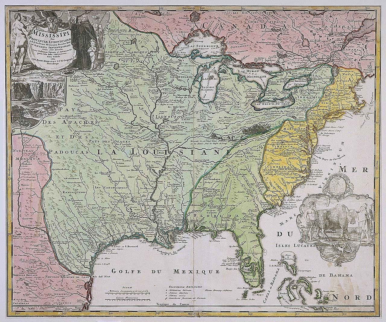
Mapa da Louisiana (Mississippi) de Johann Baptista Homann
Mapa gravado e colorido à mão da bacia do rio Mississippi e da costa do Golfo, com regiões verdes, rosa e amarelas e um cartucho decorativo no canto superior esquerdo com figuras e uma cachoeira. Legendas em francês indicam o Golfe du Mexique, a Louisiane e os Grandes Lagos.
- Artista
- Johann Baptista Homann
- Data
- after 1718
- Técnica
- Etching and engraving, hand-colored, on white laid paper
- Fonte
- Smithsonian (Cooper Hewitt, Smithsonian Design Museum)
- Tamanho
- 1280 × 1068 px
Domínio público · Smithsonian (Cooper Hewitt, Smithsonian Design Museum) releases this image under CC0 (undated).
Direitos verificados 2026-11-05 · nível A · conforme a fonte: CC0 (Smithsonian Open Access)
Direitos verificados 2026-11-05 · nível A · conforme a fonte: CC0 (Smithsonian Open Access)
Crédito (bem-vindo, não obrigatório em obras de domínio público): Smithsonian Institution, Cooper Hewitt, Smithsonian Design Museum